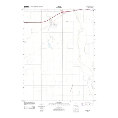
2010 Map of Wiggins
USGS Topo · Published 2010About this map
Wiggins serves as the primary hub of this Morgan County landscape, positioned where the high plains transition into the broad drainage basins of the South Platte valley. The town layout is clearly defined against the surrounding agricultural grid, with the Wiggins Cemetery located just to the northeast along the highway corridor. The geography is dominated by a series of intermittent watercourses, including Kiowa Creek and Rock Creek to the west, which carve shallow paths toward the north. To the east, the wide, sandy bed of Bijou Creek serpentines through the terrain, joined by Antelope Creek as it passes near the open expanse of Antelope Flats. This 2010 survey illustrates the persistence of these traditional plains drainage patterns alongside modern transportation infrastructure, providing a precise record of the land's hydrology and small-town development in the early 21st century.
Find a feature on this map
7 named features on this map. Tap any name to fly to it.
Don’t see what you’re looking for? This feature index may not catch every label — zoom into the map to look around manually.
Map Details
Editions of this 2010 Wiggins Map
This is the sole edition of this map. No revisions or reprints were ever made.
Other maps of this area

1950 · Wiggins
USGS Topo · 1:24,000

1950 · Wiggins SW
USGS Topo · 1:24,000

1950 · Masters
USGS Topo · 1:24,000

1950 · Hoyt
USGS Topo · 1:24,000

1951 · Hoyt
USGS Topo · 1:24,000

1951 · Masters
USGS Topo · 1:24,000

1951 · Weldona
USGS Topo · 1:24,000

1951 · Orchard
USGS Topo · 1:24,000

1951 · Omar
USGS Topo · 1:24,000

1954 · Sterling
USGS Topo · 1:250,000