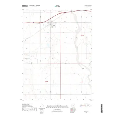
2019 Map of Wiggins
USGS Topo · Published 2019About this map
The town of Wiggins serves as the focal point of this high-plains landscape in Morgan County, situated just south of the Interstate 76 corridor. A traditional grid of residential streets including Main St and Central Ave anchors the community, which is supported by a local Po and the Wiggins Cem located on the eastern edge of town. The surrounding terrain is defined by wide drainage systems that cut through the agricultural land, most notably the broad, braided path of Bijou Creek flowing from south to north. Smaller ephemeral waterways like Kiowa Cr, Rock Cr, and Antelope Cr reveal the natural hydrology of the area before they reach the higher ground of Antelope Flats. The map illustrates a highly organized section-line road network that governs the rural landscape, facilitating movement between the various townships of the Public Land Survey System.
Find a feature on this map
41 named features on this map. Tap any name to fly to it.
Don’t see what you’re looking for? This feature index may not catch every label — zoom into the map to look around manually.
Map Details
Editions of this 2019 Wiggins Map
This is the sole edition of this map. No revisions or reprints were ever made.
Other maps of this area

1950 · Wiggins
USGS Topo · 1:24,000

1950 · Wiggins SW
USGS Topo · 1:24,000

1950 · Masters
USGS Topo · 1:24,000

1950 · Hoyt
USGS Topo · 1:24,000

1951 · Hoyt
USGS Topo · 1:24,000

1951 · Masters
USGS Topo · 1:24,000

1951 · Weldona
USGS Topo · 1:24,000

1951 · Orchard
USGS Topo · 1:24,000

1951 · Omar
USGS Topo · 1:24,000

1954 · Sterling
USGS Topo · 1:250,000