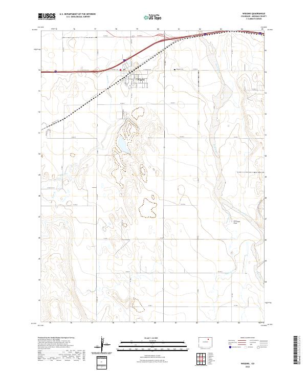
2022 Map of Wiggins
USGS Topo · Published 2022About this map
Wiggins serves as the focal point of this Eastern Plains study, situated where the high-speed corridors of Interstate 76 and the N I - 76 Frontage Rd intersect with the agricultural grid of Morgan County. The landscape is defined by the braided path of Bijou Creek as it meanders north toward the Platte, carving a wide valley through the arid terrain of Antelope Flats. This 2022 survey captures the modern layout of the town, from the municipal core around Central Ave and the Post Office to the nearby Wiggins Cem. Outside the residential center, the map illustrates an extensive network of rural roads such as Co RD Q and Co RD P that support the region's farming and ranching heritage. Several seasonal drainages, including Kiowa Cr and Antelope Cr, underscore the reliance on local hydrology in this semi-arid high plains environment.
Find a feature on this map
41 named features on this map. Tap any name to fly to it.
Don’t see what you’re looking for? This feature index may not catch every label — zoom into the map to look around manually.
Map Details
Editions of this 2022 Wiggins Map
This is the sole edition of this map. No revisions or reprints were ever made.
Other maps of this area

1950 · Wiggins
USGS Topo · 1:24,000

1950 · Wiggins SW
USGS Topo · 1:24,000

1950 · Masters
USGS Topo · 1:24,000

1950 · Hoyt
USGS Topo · 1:24,000

1951 · Hoyt
USGS Topo · 1:24,000

1951 · Masters
USGS Topo · 1:24,000

1951 · Weldona
USGS Topo · 1:24,000

1951 · Orchard
USGS Topo · 1:24,000

1951 · Omar
USGS Topo · 1:24,000

1954 · Sterling
USGS Topo · 1:250,000