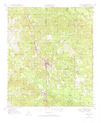
1947 Map of Wiggins
USGS Topo · Published 1970About this map
The timberlands of the De Soto National Forest define this 1940s landscape, with Wiggins serving as the central hub for the surrounding pine belt. The Illinois Central railroad bisects the region, connecting small trackside communities such as Bond and Fruitland Park. Educational and religious life is well-documented through numerous rural landmarks like Rosenwall Sch, Vocational High Sch, and Andrews Chapel.
Find a feature on this map
88 named features on this map. Tap any name to fly to it.
Don’t see what you’re looking for? This feature index may not catch every label — zoom into the map to look around manually.
Map Details
Editions of this 1947 Wiggins Map
2 editions found
Other maps of this area

1947 · Beaumont
USGS Topo · 1:62,500

1947 · Wiggins
USGS Topo · 1:62,500

1947 · New Augusta
USGS Topo · 1:62,500

1947 · Benndale
USGS Topo · 1:62,500

1949 · Wiggins
USGS Topo · 1:62,500

1949 · Beaumont
USGS Topo · 1:62,500

1949 · New Augusta
USGS Topo · 1:62,500

1949 · Benndale
USGS Topo · 1:62,500

1953 · Hattiesburg
USGS Topo · 1:250,000

1953 · Mobile
USGS Topo · 1:250,000