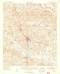
1949 Map of Wiggins
USGS Topo · Published 1949About this map
De Soto National Forest blankets much of the terrain in this 1940s survey, where the Illinois Central railroad serves as the primary spine for settlements like Wiggins, Bond, and Perkinston. The map reveals a landscape heavily defined by its drainage systems and small rural communities, with numerous schools and churches such as Forrest Maxie Sch and St Paul Ch providing central gathering points for residents. The southern portion of the sheet is marked by the winding path of Red Creek and Ten Mile Creek, which cut through a region of low-lying bays and branches including Hickman Bay and India Bay. This era shows a transition in Mississippi's piney woods, where established town centers like Wiggins with its Water tower contrast with the surrounding timberlands and family landmarks like John Willis Chapel and the Maxie Fire Tower.
Find a feature on this map
78 named features on this map. Tap any name to fly to it.
Don’t see what you’re looking for? This feature index may not catch every label — zoom into the map to look around manually.
Map Details
Editions of this 1949 Wiggins Map
2 editions found
Other maps of this area

1947 · Beaumont
USGS Topo · 1:62,500

1947 · Wiggins
USGS Topo · 1:62,500

1947 · New Augusta
USGS Topo · 1:62,500

1947 · Benndale
USGS Topo · 1:62,500

1949 · Wiggins
USGS Topo · 1:62,500

1949 · Beaumont
USGS Topo · 1:62,500

1949 · New Augusta
USGS Topo · 1:62,500

1949 · Benndale
USGS Topo · 1:62,500

1953 · Hattiesburg
USGS Topo · 1:250,000

1953 · Mobile
USGS Topo · 1:250,000