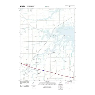
2010 Map of Wightmans Grove
USGS Topo · Published 2010About this map
The Sandusky River dominates this portion of Sandusky County, winding through low-lying terrain before reaching the bay. The settlement pattern is defined by riverfront communities and landing points such as Wightmans Grove, Shorewood Village, and Shannon. These locations, along with Riverfront Marina and Memory Marina, highlight the area's transition from agricultural use to recreational water access. Inland, the landscape is crisscrossed by an extensive network of drainage features like Yellow Swale, Cottonwood Swale, and Druckenmiller Ditch, illustrating long-standing efforts to manage the wet prairie environment for farming.
Find a feature on this map
87 named features on this map. Tap any name to fly to it.
Don’t see what you’re looking for? This feature index may not catch every label — zoom into the map to look around manually.
Map Details
Editions of this 2010 Wightmans Grove Map
This is the sole edition of this map. No revisions or reprints were ever made.
Other maps of this area

1900 · Oak Harbor
USGS Topo · 1:62,500

1901 · Put-In-Bay
USGS Topo · 1:62,500

1901 · Bellevue
USGS Topo · 1:62,500

1901 · Fremont
USGS Topo · 1:62,500

1903 · Bellevue
USGS Topo · 1:62,500

1903 · Fremont
USGS Topo · 1:62,500

1903 · Put In Bay
USGS Topo · 1:62,500

1952 · Oak Harbor
USGS Topo · 1:24,000

1952 · Lacarne
USGS Topo · 1:24,000

1952 · Oak Harbor
USGS Topo · 1:62,500