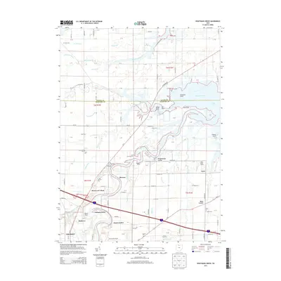
2013 Map of Wightmans Grove
USGS Topo · Published 2013About this map
The Sandusky River winds toward its mouth at Muddy Creek Bay in this 2013 survey, revealing a landscape defined by its connection to Lake Erie. Along the riverbanks, recreational and residential clusters like Wightmans Grove, Shorewood Village, and Schlegels Grove mark the shoreline. The area is dense with family and community history, evidenced by a high concentration of burial grounds including Saint Philomena Cem, Brier Hill Cem, and Trinity Cem.
Find a feature on this map
83 named features on this map. Tap any name to fly to it.
Don’t see what you’re looking for? This feature index may not catch every label — zoom into the map to look around manually.
Map Details
Editions of this 2013 Wightmans Grove Map
This is the sole edition of this map. No revisions or reprints were ever made.
Other maps of this area

1900 · Oak Harbor
USGS Topo · 1:62,500

1901 · Put-In-Bay
USGS Topo · 1:62,500

1901 · Bellevue
USGS Topo · 1:62,500

1901 · Fremont
USGS Topo · 1:62,500

1903 · Bellevue
USGS Topo · 1:62,500

1903 · Fremont
USGS Topo · 1:62,500

1903 · Put In Bay
USGS Topo · 1:62,500

1952 · Oak Harbor
USGS Topo · 1:24,000

1952 · Lacarne
USGS Topo · 1:24,000

1952 · Oak Harbor
USGS Topo · 1:62,500