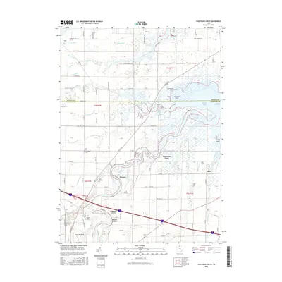
2016 Map of Wightmans Grove
USGS Topo · Published 2016About this map
The Sandusky River winds toward its outlet at Lake Erie, defining the low-lying geography of this portion of Sandusky County. The river’s path is flanked by intricate wetlands and bayous, including Green Bayou and Redhead Cove, while the surrounding plains are marked by an extensive drainage network of ditches such as Mehlow Ditch and Druckenmiller Ditch. This landscape supported a series of small, dispersed settlements including Wightmans Grove, Shannon, and Schlegels Grove, many of which grew along the riverbanks or at the intersections of local roads like N State Rte 53.
Find a feature on this map
135 named features on this map. Tap any name to fly to it.
Don’t see what you’re looking for? This feature index may not catch every label — zoom into the map to look around manually.
Map Details
Editions of this 2016 Wightmans Grove Map
This is the sole edition of this map. No revisions or reprints were ever made.
Other maps of this area

1900 · Oak Harbor
USGS Topo · 1:62,500

1901 · Put-In-Bay
USGS Topo · 1:62,500

1901 · Bellevue
USGS Topo · 1:62,500

1901 · Fremont
USGS Topo · 1:62,500

1903 · Bellevue
USGS Topo · 1:62,500

1903 · Fremont
USGS Topo · 1:62,500

1903 · Put In Bay
USGS Topo · 1:62,500

1952 · Oak Harbor
USGS Topo · 1:24,000

1952 · Lacarne
USGS Topo · 1:24,000

1952 · Oak Harbor
USGS Topo · 1:62,500