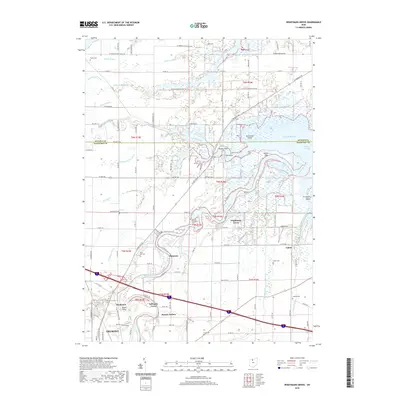
2019 Map of Wightmans Grove
USGS Topo · Published 2019About this map
The Sandusky River winds toward its outlet at Muddy Creek Bay and Lake Erie in this coastal landscape of northern Ohio. The terrain is defined by a intricate system of wetlands and inlets, including Yellow Swale, Cottonwood Swale, and Green Bayou, reflecting the marshy character of the lake's southwestern shore. Small settlements like Wightmans Grove and Shannon are interspersed among extensive drainage networks such as Druckenmiller Ditch and Mehlow Ditch, which were essential for managing the low-lying agricultural lands of Sandusky and Ottawa counties. Genealogists will find several burial grounds identified throughout the area, including Saint Philomena Cem, Brier Hill Cem, and Gibbs Cem, often located near named family groves like Schlegels Grove. The map also captures the local industry and community life through features like Gibbs Field and the residential cluster at Muncie Hollow, providing a detailed look at the rural fabric near Fremont.
Find a feature on this map
73 named features on this map. Tap any name to fly to it.
Don’t see what you’re looking for? This feature index may not catch every label — zoom into the map to look around manually.
Map Details
Editions of this 2019 Wightmans Grove Map
This is the sole edition of this map. No revisions or reprints were ever made.
Other maps of this area

1900 · Oak Harbor
USGS Topo · 1:62,500

1901 · Put-In-Bay
USGS Topo · 1:62,500

1901 · Bellevue
USGS Topo · 1:62,500

1901 · Fremont
USGS Topo · 1:62,500

1903 · Bellevue
USGS Topo · 1:62,500

1903 · Fremont
USGS Topo · 1:62,500

1903 · Put In Bay
USGS Topo · 1:62,500

1952 · Oak Harbor
USGS Topo · 1:24,000

1952 · Lacarne
USGS Topo · 1:24,000

1952 · Oak Harbor
USGS Topo · 1:62,500