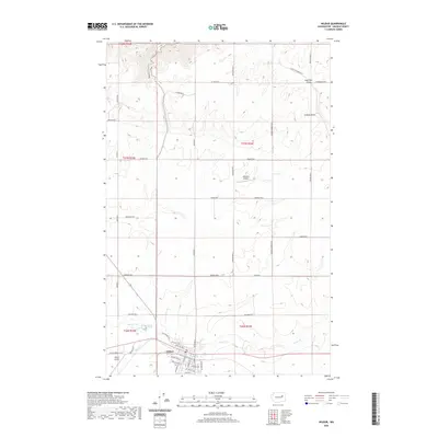
2020 Map of Wilbur
USGS Topo · Published 2020About this map
Wilbur serves as the primary hub in this portion of Lincoln County, situated in the southern reaches of the map where a structured grid of streets like College Ave SW and NW Cole Ave meets the rural landscape. The area is defined by a network of drainage ways and seasonal water features, including the prominent Sage Hen Draw and Corbett Draw in the northeast, which carve through the plateau. Aviation is a notable part of the local infrastructure, with both the Wilbur Airport near the town center and the private Gollehon Airport further north. The surrounding countryside is divided by a geometric web of county roads such as Potlatch Rd N and Gollehon Rd N, reflecting the agricultural land divisions of the Inland Empire. Small water bodies like Bandys Lake and the winding Goose Cr provide local points of interest amidst the expansive wheat-growing country.
Find a feature on this map
52 named features on this map. Tap any name to fly to it.
Don’t see what you’re looking for? This feature index may not catch every label — zoom into the map to look around manually.
Map Details
Editions of this 2020 Wilbur Map
This is the sole edition of this map. No revisions or reprints were ever made.
Other maps of this area

1948 · Grand Coulee Dam
USGS Topo · 1:62,500

1948 · Wilbur
USGS Topo · 1:62,500

1950 · Wilbur
USGS Topo · 1:62,500

1950 · Grand Coulee Dam
USGS Topo · 1:62,500

1953 · Ritzville
USGS Topo · 1:250,000

1959 · Ritzville
USGS Topo · 1:250,000

1965 · Ritzville
USGS Topo · 1:250,000

1969 · Govan
USGS Topo · 1:24,000

1969 · Creston Butte
USGS Topo · 1:24,000

1969 · Wagner Lake
USGS Topo · 1:24,000