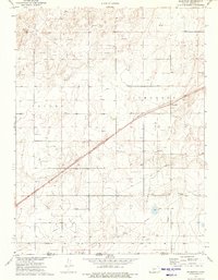
1974 Map of Wilburton
USGS Topo · Published 1975About this map
Wilburton sits at the heart of this mid-1970s survey, where the high plains of Morton County meet the Oklahoma border. The landscape is defined by the industrial footprint of the Wilburton Gas Field, a dense network of energy extraction marked by numerous Gas Wells, an Oil Well, and a central Compressor Station. This extractive activity is bisected by the diagonal corridor of the Atchison Topeka and Santa Fe railroad, which historically linked these remote prairie outposts to larger markets.
Find a feature on this map
12 named features on this map. Tap any name to fly to it.
Don’t see what you’re looking for? This feature index may not catch every label — zoom into the map to look around manually.
Map Details
Editions of this 1974 Wilburton Map
This is the sole edition of this map. No revisions or reprints were ever made.
Other maps of this area

1954 · Perryton
USGS Topo · 1:250,000

1955 · Dodge City
USGS Topo · 1:250,000

1958 · Perryton
USGS Topo · 1:250,000

1958 · Dodge City
USGS Topo · 1:250,000

1959 · Dodge City
USGS Topo · 1:250,000
1973 · Elkhart South
USGS Topo · 1:24,000

1973 · Rolla NW
USGS Topo · 1:24,000

1973 · Elkhart NE
USGS Topo · 1:24,000
1973 · Elkhart North
USGS Topo · 1:24,000
1973 · Elkhart NW
USGS Topo · 1:24,000