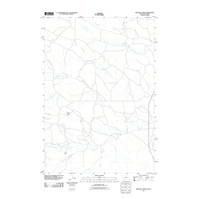
2011 Map of Wild Bill Creek
USGS Topo · Published 2011About this map
Wild Bill Creek and the surrounding drainage basins of Campbell County define this 2011 landscape near the Montana-Wyoming border. The terrain is characterized by a dense network of watercourses, including Badger Creek, Blacktail Creek, and the various branches of the Bowers Creek system. This area reflects the rural infrastructure of the early 21st century, where ranch roads like Mader-Allen Rd and Bowers Creek Rd provide access to the high plains.
Find a feature on this map
13 named features on this map. Tap any name to fly to it.
Don’t see what you’re looking for? This feature index may not catch every label — zoom into the map to look around manually.
Map Details
Editions of this 2011 Wild Bill Creek Map
This is the sole edition of this map. No revisions or reprints were ever made.
Other maps of this area

1954 · Ekalaka
USGS Topo · 1:250,000

1954 · Gillette
USGS Topo · 1:250,000

1955 · Gillette
USGS Topo · 1:250,000

1956 · Ekalaka
USGS Topo · 1:250,000

1958 · Gillette
USGS Topo · 1:250,000

1958 · Ekalaka
USGS Topo · 1:250,000

1962 · Gillette
USGS Topo · 1:250,000

1965 · Ekalaka
USGS Topo · 1:250,000

1970 · Pine Creek
USGS Topo · 1:24,000

1970 · Wild Bill Creek
USGS Topo · 1:24,000