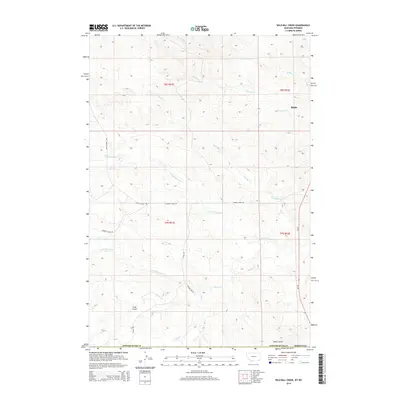
2014 Map of Wild Bill Creek
USGS Topo · Published 2014About this map
The small settlement of Biddle serves as a lone point of habitation in this high-plains landscape where the borders of Montana and Wyoming meet. Defined by a complex drainage network, the area is etched by the meandering courses of Wild Bill Cr, Blacktail Cr, and Badger Cr as they flow across the divide. The terrain is marked by significant geographic landmarks like Coal Gulch and Fuller Gulch, which reflect the region's geological and extractive history. A network of rural routes, including Butte Creek Rd and Bowers Creek Rd, connect isolated ranching properties across Powder River Co, revealing the sparse but deliberate layout of land use in the early 21st century. The map provides a clear record of the intersection between the natural hydrology of N Fork Bowers Cr and the structured township and range system that continues to govern land management here.
Find a feature on this map
22 named features on this map. Tap any name to fly to it.
Don’t see what you’re looking for? This feature index may not catch every label — zoom into the map to look around manually.
Map Details
Editions of this 2014 Wild Bill Creek Map
This is the sole edition of this map. No revisions or reprints were ever made.
Other maps of this area

1954 · Ekalaka
USGS Topo · 1:250,000

1954 · Gillette
USGS Topo · 1:250,000

1955 · Gillette
USGS Topo · 1:250,000

1956 · Ekalaka
USGS Topo · 1:250,000

1958 · Gillette
USGS Topo · 1:250,000

1958 · Ekalaka
USGS Topo · 1:250,000

1962 · Gillette
USGS Topo · 1:250,000

1965 · Ekalaka
USGS Topo · 1:250,000

1970 · Pine Creek
USGS Topo · 1:24,000

1970 · Wild Bill Creek
USGS Topo · 1:24,000