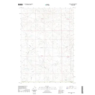
2020 Map of Wild Bill Creek
USGS Topo · Published 2020About this map
Wild Bill Cr winds through this sparsely settled corner of the Powder River Basin, marking a landscape defined by its complex drainage network along the Wyoming and Montana border. The territory is characterized by deep ravines and intermittent waterways, such as Coal Gulch and Fuller Gulch, which carve through the high plains. A network of rural routes, including Butte Creek Rd and Mader-Allen Rd, provides the primary access to the scattered homesteads and ranching tracts within Powder River Co. Significant water features like Little Bowers Cr and N Fork Bowers Cr illustrate the seasonal flow patterns essential to the local livestock economy. This survey documents the modern layout of the Public Land Survey System, showing the township and range boundaries of t8s r51e and t9s r51e that still govern land ownership in this remote cattle country.
Find a feature on this map
19 named features on this map. Tap any name to fly to it.
Don’t see what you’re looking for? This feature index may not catch every label — zoom into the map to look around manually.
Map Details
Editions of this 2020 Wild Bill Creek Map
This is the sole edition of this map. No revisions or reprints were ever made.
Other maps of this area

1954 · Ekalaka
USGS Topo · 1:250,000

1954 · Gillette
USGS Topo · 1:250,000

1955 · Gillette
USGS Topo · 1:250,000

1956 · Ekalaka
USGS Topo · 1:250,000

1958 · Gillette
USGS Topo · 1:250,000

1958 · Ekalaka
USGS Topo · 1:250,000

1962 · Gillette
USGS Topo · 1:250,000

1965 · Ekalaka
USGS Topo · 1:250,000

1970 · Pine Creek
USGS Topo · 1:24,000

1970 · Wild Bill Creek
USGS Topo · 1:24,000