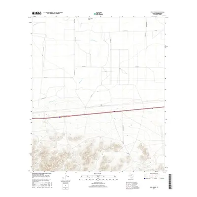
2016 Map of Wild Horse
USGS Topo · Published 2016About this map
Wild Horse stands as the central point of reference in this arid Culberson County landscape, where the topography transitions from the high peaks of the Wild Horse range to the alluvial drainage of the Wild Horse Draw. The map illustrates a network of ranching roads that navigate the desert floor, including Brookshire Rd, Ramona Rd, and Sunsites Rd, which serve scattered operations such as the Wild Horse Ranch.
Find a feature on this map
16 named features on this map. Tap any name to fly to it.
Don’t see what you’re looking for? This feature index may not catch every label — zoom into the map to look around manually.
Map Details
Editions of this 2016 Wild Horse Map
This is the sole edition of this map. No revisions or reprints were ever made.
Other maps of this area

1892 · Chispa
USGS Topo · 1:125,000

1895 · Chispa
USGS Topo · 1:125,000

1897 · Chispa
USGS Topo · 1:125,000

1906 · Van Horn
USGS Topo · 1:125,000

1954 · Van Horn
USGS Topo · 1:250,000

1958 · Van Horn
USGS Topo · 1:250,000

1959 · Marfa
USGS Topo · 1:250,000
1964 · Goat Canyon
USGS Topo · 1:24,000

1964 · Wild Horse
USGS Topo · 1:24,000

1964 · Watson Ranch
USGS Topo · 1:24,000