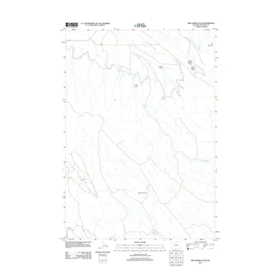
2012 Map of Wild Horse Flats
USGS Topo · Published 2012About this map
Wild Horse Flats dominates the southern landscape of this Big Horn County region, where the arid Wyoming terrain meets a sophisticated network of early 21st-century water management. The infrastructure here is defined by gravity-fed irrigation systems like the Shell Canal and Thompson Lateral, which feed several named catchments including Carey Reservoir and Jones Reservoir. These features highlight the importance of water rights and agricultural engineering in the high plains. Industrial activity is grounded by the Lamb Oil Field in the west, while the eastern topography rises toward Fox Mountain. Numerous named drainage features such as North Sheldon Gulch and Carey Draw underscore the complex erosion patterns that define this section of the Bighorn Basin, providing a clear record of land use and resource extraction during this era.
Find a feature on this map
17 named features on this map. Tap any name to fly to it.
Don’t see what you’re looking for? This feature index may not catch every label — zoom into the map to look around manually.
Map Details
Editions of this 2012 Wild Horse Flats Map
This is the sole edition of this map. No revisions or reprints were ever made.
Other maps of this area

1898 · Bald Mountain
USGS Topo · 1:125,000

1901 · Bald Mountain
USGS Topo · 1:125,000

1955 · Cody
USGS Topo · 1:250,000

1955 · Sheridan
USGS Topo · 1:250,000

1958 · Cody
USGS Topo · 1:250,000

1958 · Sheridan
USGS Topo · 1:250,000

1960 · Manderson
USGS Topo · 1:24,000

1960 · Manderson NE
USGS Topo · 1:24,000

1960 · Devils Kitchen
USGS Topo · 1:24,000

1960 · Shell
USGS Topo · 1:24,000