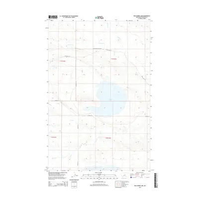
2014 Map of Wild Horse Lake
USGS Topo · Published 2014About this map
Wild Horse Lake sits at the center of this Petroleum County landscape, characterizing the seasonal drainage patterns of the Central Montana plains. The terrain is defined by a network of intermittent watercourses including Box Elder Cr and the S Fork Bear Cr to the north, and Duck Cr and Fords Cr to the south. These creek beds carve through the topography, leading toward the southern edge of the map where War Horse Lake begins to emerge.
Find a feature on this map
14 named features on this map. Tap any name to fly to it.
Don’t see what you’re looking for? This feature index may not catch every label — zoom into the map to look around manually.
Map Details
Editions of this 2014 Wild Horse Lake Map
This is the sole edition of this map. No revisions or reprints were ever made.
Other maps of this area

1954 · Lewistown
USGS Topo · 1:250,000

1959 · Lewistown
USGS Topo · 1:250,000

1985 · Bear Creek Reservoir SE
USGS Topo · 1:24,000

1985 · Valentine
USGS Topo · 1:24,000
1985 · Bear Creek Reservoir
USGS Topo · 1:24,000

1986 · Wild Horse Lake
USGS Topo · 1:24,000

1986 · Briggs Coulee
USGS Topo · 1:24,000

1986 · Dry Blood Creek West
USGS Topo · 1:24,000

1986 · Teigen NW
USGS Topo · 1:24,000

1986 · Teigen
USGS Topo · 1:24,000