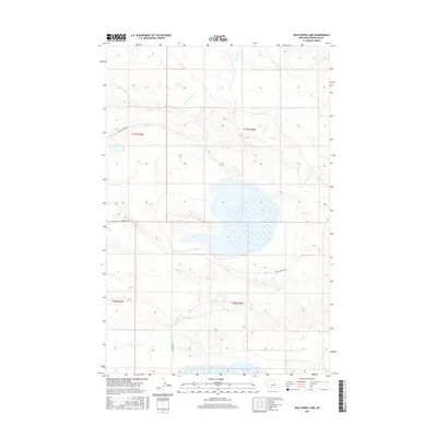
2017 Map of Wild Horse Lake
USGS Topo · Published 2017About this map
Wild Horse Lake and its associated wetlands dominate this portion of Petroleum County, where the seasonal hydrology of the Montana plains is clearly visible. The terrain is defined by a complex network of intermittent drainages, including Box Elder Cr, Duck Cr, and Fords Cr, which feed into the larger basins of the region. This 2017 survey details a landscape primarily utilized for ranching and resource management, evidenced by the presence of Welter Divide Rd and Blakeslee Rd providing the only significant access points through the prairie. To the south, the edge of War Horse Lake appears, marking another significant water feature in this sparsely populated region. The map provides precise documentation of elevation contours and township boundaries like t17n r24e, reflecting the enduring rectangular survey system that governs this part of the West.
Find a feature on this map
12 named features on this map. Tap any name to fly to it.
Don’t see what you’re looking for? This feature index may not catch every label — zoom into the map to look around manually.
Map Details
Editions of this 2017 Wild Horse Lake Map
This is the sole edition of this map. No revisions or reprints were ever made.
Other maps of this area

1954 · Lewistown
USGS Topo · 1:250,000

1959 · Lewistown
USGS Topo · 1:250,000

1985 · Bear Creek Reservoir SE
USGS Topo · 1:24,000

1985 · Valentine
USGS Topo · 1:24,000
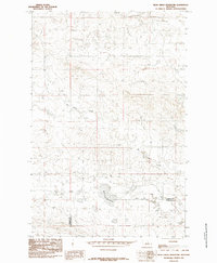
1985 · Bear Creek Reservoir
USGS Topo · 1:24,000

1986 · Wild Horse Lake
USGS Topo · 1:24,000

1986 · Briggs Coulee
USGS Topo · 1:24,000

1986 · Dry Blood Creek West
USGS Topo · 1:24,000

1986 · Teigen NW
USGS Topo · 1:24,000

1986 · Teigen
USGS Topo · 1:24,000