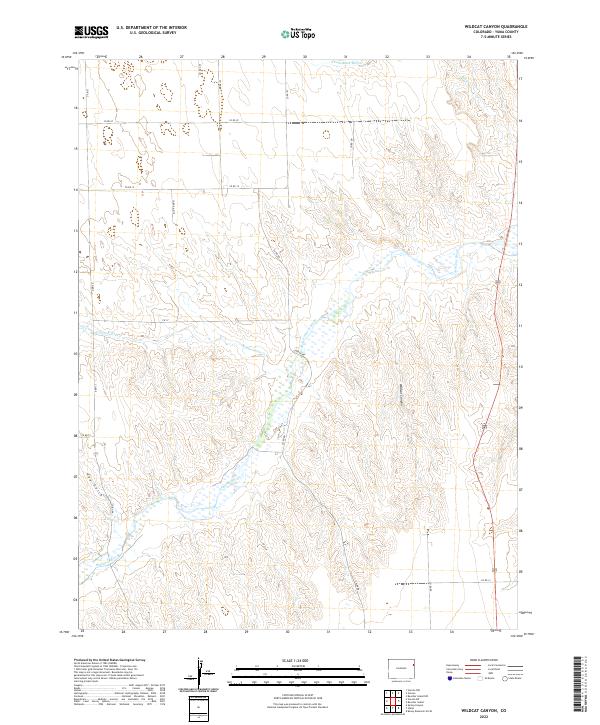
2022 Map of Wildcat Canyon
USGS Topo · Published 2022About this map
The Arikaree River winds through this section of Yuma County, carving a distinct hydrological pattern across the high plains landscape. This 2022 survey documents the drainage basins that define the local topography, most notably the deep incision of Wildcat Canyon and the secondary flow of Copperkettle Cr. The terrain is characterized by a network of seasonal washes and gulches, such as Hay Gulch and Sand Cr, which feed into the primary river valley.
Find a feature on this map
24 named features on this map. Tap any name to fly to it.
Don’t see what you’re looking for? This feature index may not catch every label — zoom into the map to look around manually.
Map Details
Editions of this 2022 Wildcat Canyon Map
This is the sole edition of this map. No revisions or reprints were ever made.
Other maps of this area

1950 · Bonny Reservoir
USGS Topo · 1:62,500

1954 · Limon
USGS Topo · 1:250,000

1957 · Limon
USGS Topo · 1:250,000

1958 · Limon
USGS Topo · 1:250,000

1963 · Vernon
USGS Topo · 1:24,000

1963 · Beecher Island
USGS Topo · 1:24,000

1963 · Beecher Island NW
USGS Topo · 1:24,000

1963 · Wildcat Canyon
USGS Topo · 1:24,000

1968 · Vernon SW
USGS Topo · 1:24,000

1968 · Bonny Reservoir North
USGS Topo · 1:24,000