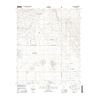
2014 Map of Wildcat Hill
USGS Topo · Published 2014About this map
Scottsdale and the rugged northern reaches of Maricopa County are defined by a landscape of prominent peaks and seasonal water sources in this 2014 record. The map reveals the expanding residential footprint reaching toward the Tonto National Forest, specifically at the Tonto Hills Subdivision. High desert terrain is punctuated by landforms such as Wildcat Hill, Granite Mtn, and Lone Mtn, while the drainage patterns of Galloway Wash and Camp Creek illustrate the natural hydrology of the area.
Find a feature on this map
72 named features on this map. Tap any name to fly to it.
Don’t see what you’re looking for? This feature index may not catch every label — zoom into the map to look around manually.
Map Details
Editions of this 2014 Wildcat Hill Map
This is the sole edition of this map. No revisions or reprints were ever made.
Other maps of this area

1904 · Camelback
USGS Topo · 1:62,500

1904 · Ft. McDowell
USGS Topo · 1:62,500

1906 · Camelsback
USGS Topo · 1:62,500

1906 · Ft. McDowell
USGS Topo · 1:62,500

1930 · Cave Creek
USGS Topo · 1:125,000

1939 · Cave Creek
USGS Topo · 1:125,000

1954 · Mesa
USGS Topo · 1:250,000

1957 · Mesa
USGS Topo · 1:250,000

1958 · Mesa
USGS Topo · 1:250,000

1960 · Mesa
USGS Topo · 1:250,000