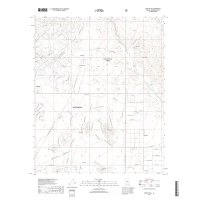
2018 Map of Wildcat Hill
USGS Topo · Published 2018About this map
Scottsdale and the planned community of Carefree anchor this desert landscape, where suburban expansion meets the protected acreage of the Tonto National Forest. The map documents a sophisticated network of recreational paths winding through the arid terrain, including the Brown's Ranch Perimeter Loop, the Broken Spoke Trail, and The Divide Trail. These pathways navigate between prominent igneous peaks such as Wildcat Hill, Granite Mtn, and Fraesfield Mtn. Water management in this dry environment is evidenced by features like Wildcat Tank, Bootlegger Tank, and the perennial Blue Mountain Spring. While residential developments like E Sterling Ridge Rd and E Apache Vistas Dr mark the northern periphery, much of the area remains dominated by natural washes such as Galloway Wash and the ephemeral drainage of Camp Cr.
Find a feature on this map
74 named features on this map. Tap any name to fly to it.
Don’t see what you’re looking for? This feature index may not catch every label — zoom into the map to look around manually.
Map Details
Editions of this 2018 Wildcat Hill Map
This is the sole edition of this map. No revisions or reprints were ever made.
Other maps of this area

1904 · Camelback
USGS Topo · 1:62,500

1904 · Ft. McDowell
USGS Topo · 1:62,500

1906 · Camelsback
USGS Topo · 1:62,500

1906 · Ft. McDowell
USGS Topo · 1:62,500

1930 · Cave Creek
USGS Topo · 1:125,000

1939 · Cave Creek
USGS Topo · 1:125,000

1954 · Mesa
USGS Topo · 1:250,000

1957 · Mesa
USGS Topo · 1:250,000

1958 · Mesa
USGS Topo · 1:250,000

1960 · Mesa
USGS Topo · 1:250,000