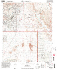
2004 Map of Wildcat Hill
USGS Topo · Published 2007About this map
Tonto National Forest land dominates this section of the Arizona desert, where the rugged topography of the Mazatzal Mountains meets the outskirts of development. The settlement at Cave Creek and the historical footprint of Browns Ranch anchor the human geography of the area, illustrating the transition from traditional ranching and mining roots to a modern recreational landscape. Distinctive peaks including Wildcat Hill, Lone Mountain, and Granite Mountain define the horizon, while important water sources like Wildcat Tank, Bootlegger Tank, and Blue Mtn Spring provided essential resources for stock and travel in an arid environment.
Find a feature on this map
18 named features on this map. Tap any name to fly to it.
Don’t see what you’re looking for? This feature index may not catch every label — zoom into the map to look around manually.
Map Details
Editions of this 2004 Wildcat Hill Map
This is the sole edition of this map. No revisions or reprints were ever made.
Other maps of this area

1904 · Camelback
USGS Topo · 1:62,500

1904 · Ft. McDowell
USGS Topo · 1:62,500

1906 · Camelsback
USGS Topo · 1:62,500

1906 · Ft. McDowell
USGS Topo · 1:62,500

1930 · Cave Creek
USGS Topo · 1:125,000

1939 · Cave Creek
USGS Topo · 1:125,000

1954 · Mesa
USGS Topo · 1:250,000

1957 · Mesa
USGS Topo · 1:250,000

1958 · Mesa
USGS Topo · 1:250,000

1960 · Mesa
USGS Topo · 1:250,000