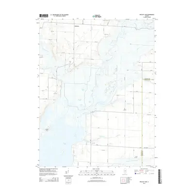
2015 Map of Wildcat Lake
USGS Topo · Published 2015About this map
Carlyle Lake and the Kaskaskia River valley define this central Illinois landscape, where the reservoir's northern reaches meet a complex system of drainage ditches and bottomland ponds. The map illustrates a transition from the structured rural grid of Pittsburg to the hydrologically complex wetlands of Otter Pond, Half Mile Pond, and Grass Pond. This area is significantly shaped by water management, evidenced by the Wildcat Ditch and the Wildcat Lake feature itself. For genealogists and local historians, the sheet is particularly valuable for its density of rural burial sites, documenting family and community history through Seminary Cem, Bear Creek Cem, and Williams Cem. The southern edge of the survey crosses from Fayette County into Marion County, where the N Fork E Fork Kaskaskia River enters the lake near Magassi Cem.
Find a feature on this map
53 named features on this map. Tap any name to fly to it.
Don’t see what you’re looking for? This feature index may not catch every label — zoom into the map to look around manually.
Map Details
Editions of this 2015 Wildcat Lake Map
This is the sole edition of this map. No revisions or reprints were ever made.
Other maps of this area

1910 · Carlyle
USGS Topo · 1:62,500

1914 · Centralia
USGS Topo · 1:62,500

1932 · Greenville
USGS Topo · 1:62,500

1935 · Centralia
USGS Topo · 1:62,500

1939 · Greenville
USGS Topo · 1:62,500

1943 · Greenville
USGS Topo · 1:62,500

1945 · Vandalia
USGS Topo · 1:62,500

1947 · Vandalia
USGS Topo · 1:62,500

1948 · Carlyle
USGS Topo · 1:62,500

1958 · Belleville
USGS Topo · 1:250,000