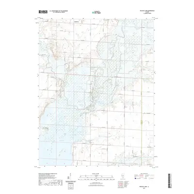
2021 Map of Wildcat Lake
USGS Topo · Published 2021About this map
Pittsburg sits near the northern boundary of this landscape, a region defined by the complex water systems of the Kaskaskia River and the northern reaches of Carlyle Lake. The terrain is a network of marshes, ponds, and drainage ditches, including Otter Pond, Grass Pond, and the Wildcat Ditch, illustrating how the bottomlands have been managed and shaped by the local hydrology. The area is heavily marked by small family and community burial sites, such as Taylor Cem, Collier Cem, and Williams Cem, which provide essential points of reference for genealogical research in this part of Fayette County. To the south, Hermit Point overlooks the widening waters of the lake, while the N Fork E Fork Kaskaskia River meanders across the southeastern corner. This survey documents the rural road grid, from Cox Ridge Rd to Shady Grove Rd, that connects these isolated settlements and water bodies.
Find a feature on this map
49 named features on this map. Tap any name to fly to it.
Don’t see what you’re looking for? This feature index may not catch every label — zoom into the map to look around manually.
Map Details
Editions of this 2021 Wildcat Lake Map
This is the sole edition of this map. No revisions or reprints were ever made.
Other maps of this area

1910 · Carlyle
USGS Topo · 1:62,500

1914 · Centralia
USGS Topo · 1:62,500

1932 · Greenville
USGS Topo · 1:62,500

1935 · Centralia
USGS Topo · 1:62,500

1939 · Greenville
USGS Topo · 1:62,500

1943 · Greenville
USGS Topo · 1:62,500

1945 · Vandalia
USGS Topo · 1:62,500

1947 · Vandalia
USGS Topo · 1:62,500

1948 · Carlyle
USGS Topo · 1:62,500

1958 · Belleville
USGS Topo · 1:250,000