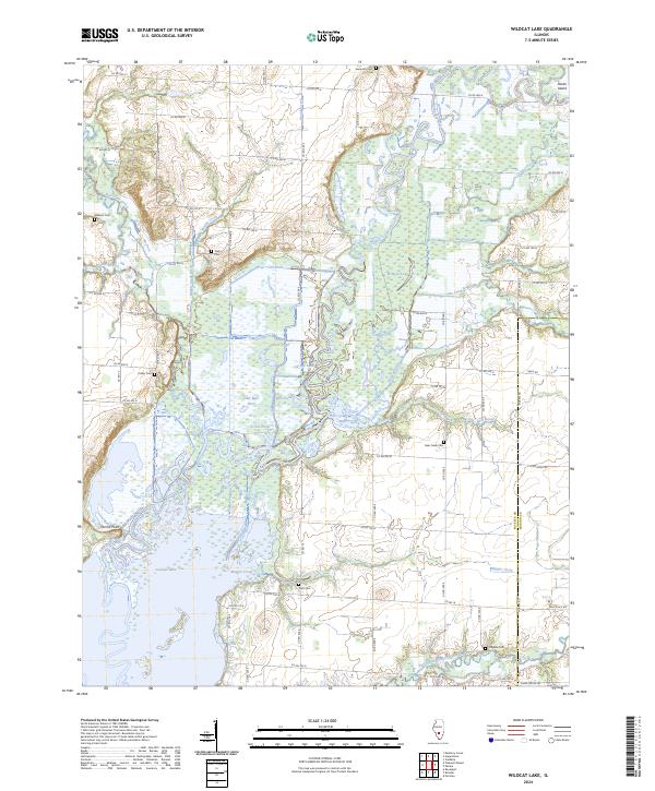
2024 Map of Wildcat Lake
USGS Topo · Published 2024About this map
Wildcat Lake and the vast waters of Carlyle Lake dominate this portion of the Kaskaskia River basin along the border of Fayette and Marion Counties. The landscape is defined by an intricate network of waterways including Muddy Creek, Hurricane Creek, and the North Fork East Fork Kaskaskia River. This region preserves numerous family and community landmarks, evidenced by a high density of rural burial grounds such as Seminary Cem, Taylor Cem, and Magassi Cem. The terrain features distinct elevations like Pecan Island in the north and Hermit Point overlooking the water in the southwest. Between the main river channel and the engineered Muddy Creek Ditch, a series of smaller bodies including Otter Pond, Half Mile Pond, and Hem Pond illustrate the bottomland ecology of the area. Large tracts of land, including those noted as Farm Service Agency Interest of Illinois, underscore the region's agricultural character.
Find a feature on this map
47 named features on this map. Tap any name to fly to it.
Don’t see what you’re looking for? This feature index may not catch every label — zoom into the map to look around manually.
Map Details
Editions of this 2024 Wildcat Lake Map
This is the sole edition of this map. No revisions or reprints were ever made.
Other maps of this area

1910 · Carlyle
USGS Topo · 1:62,500

1914 · Centralia
USGS Topo · 1:62,500

1932 · Greenville
USGS Topo · 1:62,500

1935 · Centralia
USGS Topo · 1:62,500

1939 · Greenville
USGS Topo · 1:62,500

1943 · Greenville
USGS Topo · 1:62,500

1945 · Vandalia
USGS Topo · 1:62,500

1947 · Vandalia
USGS Topo · 1:62,500

1948 · Carlyle
USGS Topo · 1:62,500

1958 · Belleville
USGS Topo · 1:250,000