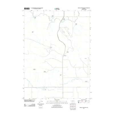
2011 Map of Wildcat Mountain
USGS Topo · Published 2011About this map
Wildcat Mountain and the high ridges of the Wildcat Hills dominate this western Nebraska landscape, where the high plains meet sharp escarpments. The area's agricultural and industrial infrastructure is defined by water management and energy extraction, featuring a series of catchments including Gering Valley Dam A through Gering Valley Dam D, and the extensive Fort Laramie Canal which snakes across the northern sections.
Find a feature on this map
31 named features on this map. Tap any name to fly to it.
Don’t see what you’re looking for? This feature index may not catch every label — zoom into the map to look around manually.
Map Details
Editions of this 2011 Wildcat Mountain Map
This is the sole edition of this map. No revisions or reprints were ever made.
Other maps of this area

1898 · Scotts Bluff
USGS Topo · 1:125,000

1954 · Scottsbluff
USGS Topo · 1:250,000

1958 · Scottsbluff
USGS Topo · 1:250,000

1963 · Scottsbluff South
USGS Topo · 1:24,000

1963 · Roubadeau Pass
USGS Topo · 1:24,000

1965 · Minatare
USGS Topo · 1:24,000

1973 · Scotts Bluff 4 NW
USGS Topo · 1:24,000

1973 · Scotts Bluff 4 SE
USGS Topo · 1:24,000

1973 · Scotts Bluff 4 NE
USGS Topo · 1:24,000

1973 · Scotts Bluff 4 SW
USGS Topo · 1:24,000