
1963 Map of Roubadeau Pass
USGS Topo · Published 1965About this map
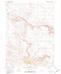
Roubadeau Pass and the surrounding bluffs of western Nebraska are captured here as they appeared in the early 1960s. The landscape is defined by the legacy of westward expansion, most notably the path of the Emigrant Trail and the Roubadeau Trading Post (Site), which served as a vital stop for travelers before the trail shifted south. The topography transitions from the high, dissected terrain of the Wildcat Hills, including Rifle Sight Pass and Saddle Gap, down to the irrigated agricultural lands of the Platte Valley.
Find a feature on this map
34 named features on this map. Tap any name to fly to it.
Don’t see what you’re looking for? This feature index may not catch every label — zoom into the map to look around manually.
Map Details
Editions of this 1963 Roubadeau Pass Map
2 editions found
Other maps of this area

1898 · Scotts Bluff
USGS Topo · 1:125,000

1954 · Scottsbluff
USGS Topo · 1:250,000

1958 · Scottsbluff
USGS Topo · 1:250,000

1960 · Stegall
USGS Topo · 1:24,000

1960 · Murray Lake
USGS Topo · 1:24,000

1963 · Scottsbluff South
USGS Topo · 1:24,000

1963 · Mitchell
USGS Topo · 1:24,000

1963 · Scottsbluff North
USGS Topo · 1:24,000
1963 · Morrill
USGS Topo · 1:24,000

1973 · Scotts Bluff 4 NW
USGS Topo · 1:24,000