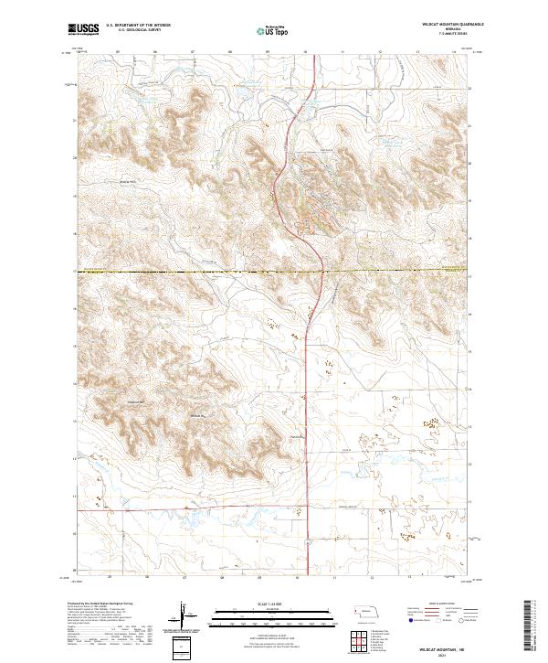
2021 Map of Wildcat Mountain
USGS Topo · Published 2021About this map
Wildcat Mountain and the surrounding Wildcat Hills dominate this high plains landscape along the border of Scotts Bluff and Banner counties. The terrain is defined by prominent escarpments and geological formations, including Hogback Mountain and the distinctive Funnel Rock. Water management is central to the area's geography, evidenced by the Fort Laramie Canal and a series of reservoirs—Gering Valley Reservoir A, B, C, and D—engineered to capture runoff from the bluffs. To the south, the valley floor opens toward Pumpkin Creek, which is flanked by a network of rural roads such as Pumpkin Creek Road and County Road 34. Modern recreational trails like the Monument View Trail and Turkey Run Trail follow the ridges, while the naming of Old Stage Hill Road suggests the historical transit corridors that once navigated these steep breaks.
Find a feature on this map
41 named features on this map. Tap any name to fly to it.
Don’t see what you’re looking for? This feature index may not catch every label — zoom into the map to look around manually.
Map Details
Editions of this 2021 Wildcat Mountain Map
This is the sole edition of this map. No revisions or reprints were ever made.
Other maps of this area

1898 · Scotts Bluff
USGS Topo · 1:125,000

1954 · Scottsbluff
USGS Topo · 1:250,000

1958 · Scottsbluff
USGS Topo · 1:250,000

1963 · Scottsbluff South
USGS Topo · 1:24,000

1963 · Roubadeau Pass
USGS Topo · 1:24,000

1965 · Minatare
USGS Topo · 1:24,000

1973 · Scotts Bluff 4 NW
USGS Topo · 1:24,000

1973 · Scotts Bluff 4 SE
USGS Topo · 1:24,000

1973 · Scotts Bluff 4 NE
USGS Topo · 1:24,000

1973 · Scotts Bluff 4 SW
USGS Topo · 1:24,000