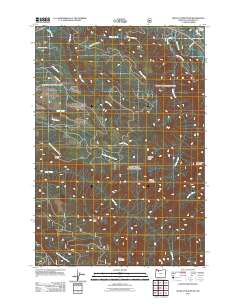
2011 Map of Wildcat Mountain
USGS Topo · Published 2011About this map
Wildcat Mountain and the surrounding high ridges of the Mount Hood National Forest dominate this 2011 survey of Clackamas County. The terrain is defined by a dense network of watercourses, including the Salmon River and Sandy River at the northeastern corner, which give way to high elevations like Old Baldy and Githens Mountain to the south. The area is largely dedicated to forest management and recreation, evidenced by the presence of the Eagle Creek Lookout and a system of forest service roads like SE Wildcat Creek Rd and SE Alder-Creek Dr. Drainage patterns are intricate, with North Fork Eagle Creek and South Fork Eagle Creek carving deep valleys through Mcintyre Ridge. Local history is anchored by these geographic landmarks, which have long served as navigational points for foresters and hikers in the Pacific Northwest.
Find a feature on this map
26 named features on this map. Tap any name to fly to it.
Don’t see what you’re looking for? This feature index may not catch every label — zoom into the map to look around manually.
Map Details
Editions of this 2011 Wildcat Mountain Map
This is the sole edition of this map. No revisions or reprints were ever made.
Other maps of this area

1916 · Estacada
USGS Topo · 1:125,000

1924 · Mount Hood
USGS Topo · 1:125,000

1927 · Mount Hood
USGS Topo · 1:125,000

1948 · Vancouver
USGS Topo · 1:250,000

1950 · Vancouver
USGS Topo · 1:250,000

1950 · Vancouver
USGS Topo · 1:250,000

1953 · The Dalles
USGS Topo · 1:250,000

1955 · Cherryville
USGS Topo · 1:62,500

1956 · The Dalles
USGS Topo · 1:250,000

1956 · Fish Creek Mtn
USGS Topo · 1:62,500