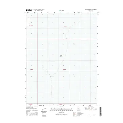
2014 Map of Wildcat Mountain SW
USGS Topo · Published 2014About this map
The Great Salt Lake Desert dominates this vast stretch of the Bonneville Basin, where the stark, level expanse of the prehistoric lakebed creates a landscape of absolute minimalist topography. Located in Tooele County, the area is defined primarily by its public land survey system divisions, including t5s r15w, t5s r14w, t6s r15w, and t6s r14w. The subtle 4250-foot contour lines reveal the extreme flatness of this environment, which historically served as a formidable barrier to westward travel and today remains a preserved segment of the arid interior West. This mapping captures the precise boundaries and section lines of the desert floor, providing a technical layout of a region where few permanent landmarks exist to guide the eye.
Find a feature on this map
7 named features on this map. Tap any name to fly to it.
Don’t see what you’re looking for? This feature index may not catch every label — zoom into the map to look around manually.
Map Details
Editions of this 2014 Wildcat Mountain SW Map
This is the sole edition of this map. No revisions or reprints were ever made.
Other maps of this area

1953 · Tooele
USGS Topo · 1:250,000

1954 · Wildcat Mtn
USGS Topo · 1:24,000

1954 · Granite Peak
USGS Topo · 1:24,000

1954 · Wildcat Mtn SE
USGS Topo · 1:24,000

1955 · Tooele
USGS Topo · 1:250,000

1973 · Wildcat Mountain SW
USGS Topo · 1:24,000

1973 · Wildcat Mountain NW
USGS Topo · 1:24,000

1973 · Gold Hill 1 SE
USGS Topo · 1:24,000

1973 · Gold Hill 1 NE
USGS Topo · 1:24,000

1973 · Granite Peak NW
USGS Topo · 1:24,000