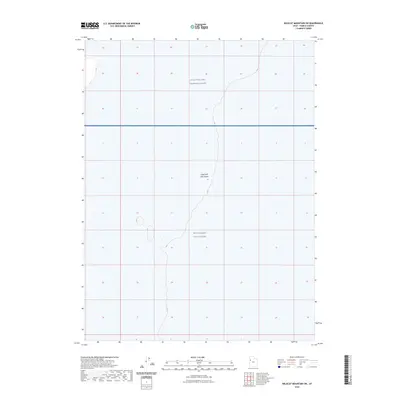
2023 Map of Wildcat Mountain SW
USGS Topo · Published 2023About this map
Great Salt Lake Desert terrain dominates this landscape, reflecting the stark and specialized use of this corner of Tooele County. The area is defined by massive federal land withdrawals, specifically the Utah Test and Training Range and the West Desert Test Center. This 2023 survey illustrates the modern boundaries of these high-security military zones, where the flat, alkaline expanse provides an ideal environment for aerospace and munitions testing. The topographic lines and section grids reveal a vast, largely undeveloped territory managed for national defense, characterized by its isolation and the nearly complete absence of civilian infrastructure or historical settlements.
Find a feature on this map
3 named features on this map. Tap any name to fly to it.
Don’t see what you’re looking for? This feature index may not catch every label — zoom into the map to look around manually.
Map Details
Editions of this 2023 Wildcat Mountain SW Map
This is the sole edition of this map. No revisions or reprints were ever made.
Other maps of this area

1953 · Tooele
USGS Topo · 1:250,000

1954 · Wildcat Mtn
USGS Topo · 1:24,000

1954 · Granite Peak
USGS Topo · 1:24,000

1954 · Wildcat Mtn SE
USGS Topo · 1:24,000

1955 · Tooele
USGS Topo · 1:250,000

1973 · Wildcat Mountain SW
USGS Topo · 1:24,000

1973 · Wildcat Mountain NW
USGS Topo · 1:24,000

1973 · Gold Hill 1 SE
USGS Topo · 1:24,000

1973 · Gold Hill 1 NE
USGS Topo · 1:24,000

1973 · Granite Peak NW
USGS Topo · 1:24,000