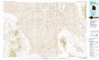
1979 Map of Wildcat Mountain
USGS Topo · Published 1979About this map
Gold Hill stands as a focal point of mineral exploration within the high desert landscape of Tooele County, where numerous mining operations are concentrated. The map documents a dense network of extraction sites including the Gold Hill Mine, Stardust Mine, and Montezuma Mine, signaling the area's intense industrial history. The rugged western terrain is dominated by the Deep Creek Range and Ochre Mountain, while the eastern portion transitions into the vast, arid expanse of the Great Salt Lake Desert.
Find a feature on this map
43 named features on this map. Tap any name to fly to it.
Don’t see what you’re looking for? This feature index may not catch every label — zoom into the map to look around manually.
Map Details
Editions of this 1979 Wildcat Mountain Map
2 editions found
Other maps of this area

1885 · Sevier Desert
USGS Topo · 1:250,000

1885 · Tooele Valley
USGS Topo · 1:250,000

1908 · Fish Springs
USGS Topo · 1:250,000

1910 · Fish Springs
USGS Topo · 1:250,000

1925 · Gold Hill
USGS Topo · 1:62,500

1928 · Gold Hill
USGS Topo · 1:62,500

1953 · Dugway Range NE
USGS Topo · 1:24,000

1953 · Dugway Range
USGS Topo · 1:62,500

1953 · Dugway Range NW
USGS Topo · 1:24,000

1953 · Tooele
USGS Topo · 1:250,000