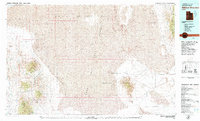
1979 Map of Wildcat Mountain
USGS Topo · Published 1979About this map
Mining operations and expansive military reservations dominate this landscape of the Great Basin during the late 1970s. The settlement of Gold Hill serves as a focal point for historic extraction, surrounded by numerous named workings including the Gold Hill Mine, Alvarado Mine, and Stardust Mine. These sites are clustered in the foothills of the Ochre Mountain and Deep Creek Range, where the transition from high peaks like Abercrombie Peak to the flat expanse of the Mud Flat is stark.
Find a feature on this map
54 named features on this map. Tap any name to fly to it.
Don’t see what you’re looking for? This feature index may not catch every label — zoom into the map to look around manually.
Map Details
Editions of this 1979 Wildcat Mountain Map
2 editions found
Other maps of this area

1885 · Sevier Desert
USGS Topo · 1:250,000

1885 · Tooele Valley
USGS Topo · 1:250,000

1908 · Fish Springs
USGS Topo · 1:250,000

1910 · Fish Springs
USGS Topo · 1:250,000

1925 · Gold Hill
USGS Topo · 1:62,500

1928 · Gold Hill
USGS Topo · 1:62,500

1953 · Dugway Range NE
USGS Topo · 1:24,000

1953 · Dugway Range
USGS Topo · 1:62,500

1953 · Dugway Range NW
USGS Topo · 1:24,000

1953 · Tooele
USGS Topo · 1:250,000