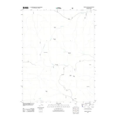
2012 Map of Wildcat Peak
USGS Topo · Published 2012About this map
The Toiyabe Range defines the high-altitude character of this central Nevada landscape, where water sources like White Rock Spring and Copper Mine Spring dictate the patterns of human activity. The map reveals a high-desert environment punctuated by significant peaks, including Wildcat Peak and Masket Peak, while drainage systems like Stoneberger Cr and Crane Cr carve through deep canyons.
Find a feature on this map
27 named features on this map. Tap any name to fly to it.
Don’t see what you’re looking for? This feature index may not catch every label — zoom into the map to look around manually.
Map Details
Editions of this 2012 Wildcat Peak Map
This is the sole edition of this map. No revisions or reprints were ever made.
Other maps of this area

1926 · Roberts Mountains
USGS Topo · 1:250,000

1929 · Roberts Mountains
USGS Topo · 1:250,000

1955 · Millett
USGS Topo · 1:250,000

1956 · Tonopah
USGS Topo · 1:250,000

1959 · Tonopah
USGS Topo · 1:250,000

1959 · Millett
USGS Topo · 1:250,000

1960 · Dianas Punch Bowl
USGS Topo · 1:62,500

1960 · Wildcat Peak
USGS Topo · 1:62,500

1962 · Tonopah
USGS Topo · 1:250,000
1971 · Jet Spring
USGS Topo · 1:24,000