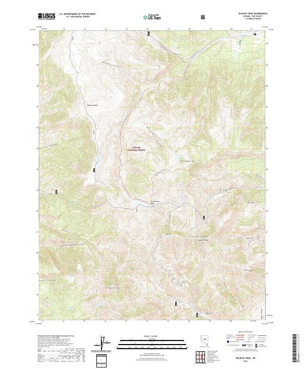
2021 Map of Wildcat Peak
USGS Topo · Published 2021About this map
The Toquima Range dominates this portion of the Toyiabe National Forest, where a network of trails and primitive roads traverses a high-elevation landscape. Concentrated around Stoneberger Basin, the drainage patterns of Stoneberger Cr and Little Stoneberger Cr define the central topography. This modern survey illustrates how water sources remain critical landmarks in the arid terrain, with White Rock Spring, Wildcat Spring, and Copper Mine Spring providing vital points of reference along the mountain flanks. Notable summits including Wildcat Peak, Diana Peak, and Masket Peak offer prominent navigational aids for those exploring the backcountry. The map also delineates specialized transit routes such as the Stoneberger Atv Trl and the Motorized North Fork Trl, reflecting the area's contemporary use for remote recreation and resource management.
Find a feature on this map
43 named features on this map. Tap any name to fly to it.
Don’t see what you’re looking for? This feature index may not catch every label — zoom into the map to look around manually.
Map Details
Editions of this 2021 Wildcat Peak Map
This is the sole edition of this map. No revisions or reprints were ever made.
Other maps of this area

1926 · Roberts Mountains
USGS Topo · 1:250,000

1929 · Roberts Mountains
USGS Topo · 1:250,000

1955 · Millett
USGS Topo · 1:250,000

1956 · Tonopah
USGS Topo · 1:250,000

1959 · Tonopah
USGS Topo · 1:250,000

1959 · Millett
USGS Topo · 1:250,000

1960 · Dianas Punch Bowl
USGS Topo · 1:62,500

1960 · Wildcat Peak
USGS Topo · 1:62,500

1962 · Tonopah
USGS Topo · 1:250,000
1971 · Jet Spring
USGS Topo · 1:24,000