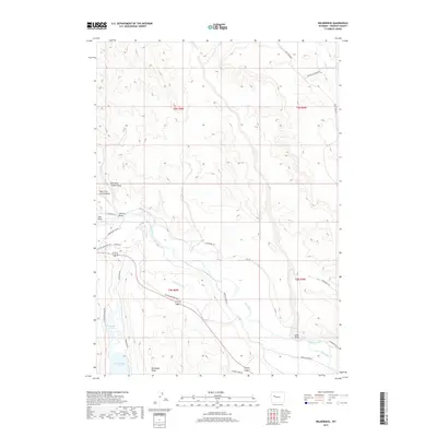
2017 Map of Wilderness
USGS Topo · Published 2017About this map
The Wind River dominates this landscape in Fremont County, its path shaped by an intricate system of agricultural irrigation. The Wind River Canal, Dinwoody Canal, and Lannigans Ditch divert water across the plains, supporting a network of rural routes like Burris Lenore Rd and Gannett Peak Rd. The area’s geography is further defined by notable water bodies such as Dinwoody Lake and the Dinwoody Lakes, which sit below the prominent Dinwoody Ridge.
Find a feature on this map
30 named features on this map. Tap any name to fly to it.
Don’t see what you’re looking for? This feature index may not catch every label — zoom into the map to look around manually.
Map Details
Editions of this 2017 Wilderness Map
This is the sole edition of this map. No revisions or reprints were ever made.
Other maps of this area

1904 · Kirwin
USGS Topo · 1:125,000

1906 · Kirwin
USGS Topo · 1:125,000

1952 · Wilderness
USGS Topo · 1:24,000

1952 · Hays Park
USGS Topo · 1:24,000

1952 · Crowheart NW
USGS Topo · 1:24,000

1952 · Blue Holes
USGS Topo · 1:24,000

1952 · Crowheart
USGS Topo · 1:24,000

1952 · Burris
USGS Topo · 1:24,000

1955 · Thermopolis
USGS Topo · 1:250,000

1958 · Thermopolis
USGS Topo · 1:250,000