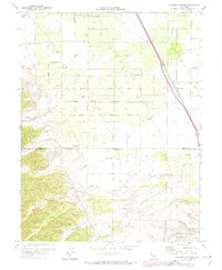
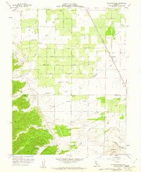
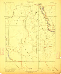
1959 Map of Wildwood School
USGS Topo · Published 1974About this map
Wildwood School and the small siding at Harrington define the agricultural landscape along the Colusa and Yolo county line during the late 1950s. The territory is marked by a transition from the level floor of the Sacramento Valley into the rising elevations of the Dunnigan Hills to the south. Water management and resource extraction are prominent, with numerous gas wells scattered among the orchard-lined roads and a Gravel Pit located near Wagner Avenue.
Find a feature on this map
32 named features on this map. Tap any name to fly to it.
Don’t see what you’re looking for? This feature index may not catch every label — zoom into the map to look around manually.
Map Details
Editions of this 1959 Wildwood School Map
3 editions found

Other maps of this area

1888 · Marysville
USGS Topo · 1:125,000

1891 · Marysville
USGS Topo · 1:125,000

1894 · Marysville
USGS Topo · 1:125,000

1895 · Marysville
USGS Topo · 1:125,000

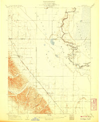
1905 · Harrington
USGS Topo · 1:24,000
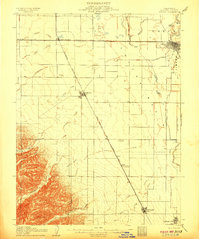
1907 · Dunnigan
USGS Topo · 1:62,500
1907 · Colusa
USGS Topo · 1:62,500
1911 · Grimes
USGS Topo · 1:31,680
1916 · Harrington
USGS Topo · 1:31,680

1916 · Hershey
USGS Topo · 1:31,680