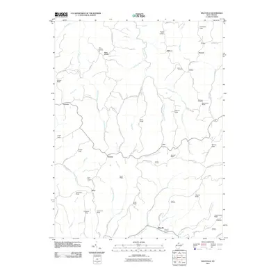
2011 Map of Wileyville
USGS Topo · Published 2011About this map
Little Fishing Creek and its many tributaries, including Hartley Run and Steel Run, define the complex network of hollows and ridges throughout this northern West Virginia landscape. Small settlements and crossroads like Wileyville, Saint Joseph, and Newdale are connected by a web of county highways that follow the high ground of Taylor Ridge, Greenfield Ridge, and Macedonia Ridge. This 2011 survey reveals a high density of family and community burial grounds, such as Pleasant Ridge Cemetery, Harland Cemetery, and Yoho Cemetery, which provide critical touchpoints for genealogical research in this rural pocket. The distribution of sites like Peabody and Dulaney alongside watercourses such as Bark Camp Run and Lynn Camp Run reflects a settlement pattern deeply tied to the local hydrology and topographic relief of the Allegheny Plateau.
Find a feature on this map
91 named features on this map. Tap any name to fly to it.
Don’t see what you’re looking for? This feature index may not catch every label — zoom into the map to look around manually.
Map Details
Editions of this 2011 Wileyville Map
This is the sole edition of this map. No revisions or reprints were ever made.
Other maps of this area

1903 · Littleton
USGS Topo · 1:62,500

1904 · Cameron
USGS Topo · 1:62,500

1905 · Littleton
USGS Topo · 1:62,500

1905 · Clarington
USGS Topo · 1:62,500

1906 · New Martinsville
USGS Topo · 1:62,500

1924 · New Martinsville
USGS Topo · 1:62,500

1924 · Littleton
USGS Topo · 1:62,500

1926 · Littleton
USGS Topo · 1:62,500

1926 · New Martinsville
USGS Topo · 1:62,500

1935 · Cameron
USGS Topo · 1:62,500