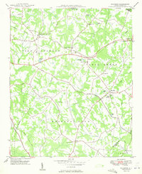
1949 Map of Wilgrove
USGS Topo · Published 1949About this map
Mint Hill and the surrounding rural landscapes of eastern Mecklenburg County are captured here just before the rapid suburbanization of the late 20th century. The geography is defined by a dense network of creek valleys, including McAlpine Creek, Irvins Creek, and Clear Creek, which dictated the placement of early settlements and road crossings. The community of Wilgrove sits along the Norfolk Southern rail line, a primary corridor that historically shaped the region's transport and trade.
Find a feature on this map
43 named features on this map. Tap any name to fly to it.
Don’t see what you’re looking for? This feature index may not catch every label — zoom into the map to look around manually.
Map Details
Editions of this 1949 Wilgrove Map
2 editions found
Other maps of this area

1905 · Charlotte
USGS Topo · 1:48,000

1907 · Charlotte
USGS Topo · 1:62,500

1941 · Charlotte
USGS Topo · 1:125,000

1942 · Charlotte
USGS Topo · 1:125,000

1948 · Derita
USGS Topo · 1:24,000

1948 · Charlotte East
USGS Topo · 1:24,000

1949 · Charlotte East
USGS Topo · 1:24,000

1949 · Harrisburg
USGS Topo · 1:24,000

1949 · Wilgrove
USGS Topo · 1:24,000

1949 · Midland
USGS Topo · 1:24,000