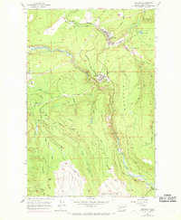
1956 Map of Wilkeson
USGS Topo · Published 1969About this map
Wilkeson and Carbonado serve as the primary anchors of this mid-century Pierce County landscape, following a narrow corridor of industrial activity defined by the Carbon River. The Northern Pacific railroad tracks wind through the valley, connecting these mining and timber communities. The terrain is marked by extractive sites including several prospects, a quarry, and various gravel pits, illustrating the era's heavy reliance on local natural resources. High above the river valleys, the Electron Lookout sits on Cowling Ridge, overlooking a complex network of creeks such as Voight Creek and Bear Creek. To the southeast, the settlements of Fairfax and Upper Fairfax represent the further reaches of development along the river, while natural features like Sunset Lake and Mowich Lake punctuate the high-elevation ridges.
Find a feature on this map
43 named features on this map. Tap any name to fly to it.
Don’t see what you’re looking for? This feature index may not catch every label — zoom into the map to look around manually.
Map Details
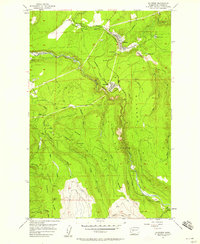
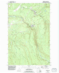
Editions of this 1956 Wilkeson Map
3 editions found
Other maps of this area

1897 · Tacoma
USGS Topo · 1:125,000

1900 · Tacoma
USGS Topo · 1:125,000

1913 · Cedar Lake
USGS Topo · 1:125,000

1924 · Mt Rainier
USGS Topo · 1:96,000

1928 · Mt Rainier
USGS Topo · 1:125,000

1937 · Eatonville
USGS Topo · 1:125,000

1942 · Lake Tapps
USGS Topo · 1:62,500

1944 · Lake Tapps
USGS Topo · 1:62,500

1950 · Yakima
USGS Topo · 1:250,000

1953 · Hoquiam
USGS Topo · 1:250,000