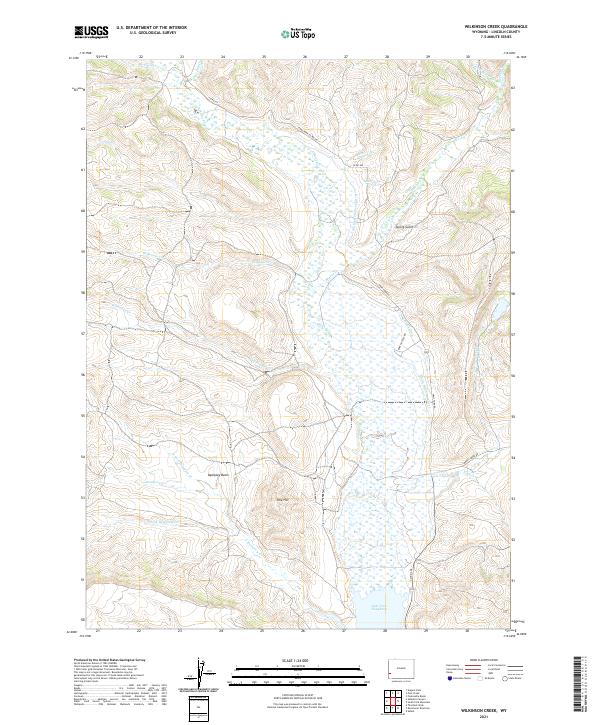
2021 Map of Wilkinson Creek
USGS Topo · Published 2021About this map
Hams Fork winds through the heart of this high-elevation landscape in Lincoln County, feeding into the northern reaches of Lake Viva Naughton. The terrain is defined by a sophisticated network of early water management, including the Johnson Spencer Ditch, E Stock Ditch, and Smith Ditch Number 1, which reflect the region's historical reliance on irrigation for ranching and livestock. Topographical landmarks such as Pink Hill and the broad Dempsey Basin dominate the central and western portions of the quadrangle, where the headwaters of N Fork Dempsey Cr and S Fork Dempsey Cr converge. This area, accessed by routes like Hams Fork Rd and Corral Creek Rd, shows a landscape shaped by both natural drainage and human engineering, with numerous smaller tributaries like Wilkinson Cr and Taylor Cr etching deep into the gulches and flats of the Wyoming range.
Find a feature on this map
34 named features on this map. Tap any name to fly to it.
Don’t see what you’re looking for? This feature index may not catch every label — zoom into the map to look around manually.
Map Details
Editions of this 2021 Wilkinson Creek Map
This is the sole edition of this map. No revisions or reprints were ever made.
Other maps of this area

1936 · Cokeville
USGS Topo · 1:96,000

1942 · Cokeville
USGS Topo · 1:125,000

1954 · Sage
USGS Topo · 1:62,500

1954 · Ogden
USGS Topo · 1:250,000

1954 · Kemmerer
USGS Topo · 1:62,500

1955 · Preston
USGS Topo · 1:250,000

1958 · Ogden
USGS Topo · 1:250,000

1958 · Preston
USGS Topo · 1:250,000

1960 · Ogden
USGS Topo · 1:250,000

1962 · Preston
USGS Topo · 1:250,000