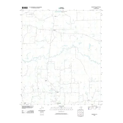
2010 Map of Wilkinson
USGS Topo · Published 2010About this map
White Oak Creek meanders through this portion of Titus County, defining a landscape of creek bottoms and low-lying wetlands. Small settlements like Wilkinson, Midway, and Argo serve as local anchors connected by a network of farm-to-market roads and county routes. The Presence of the Trix-Liz Oil Field in the northwest corner suggests the enduring importance of the petroleum industry to the local economy during the early 21st century.
Find a feature on this map
44 named features on this map. Tap any name to fly to it.
Don’t see what you’re looking for? This feature index may not catch every label — zoom into the map to look around manually.
Map Details
Editions of this 2010 Wilkinson Map
This is the sole edition of this map. No revisions or reprints were ever made.
Other maps of this area

1953 · Texarkana
USGS Topo · 1:250,000

1956 · Texarkana
USGS Topo · 1:250,000

1964 · Cuthand
USGS Topo · 1:24,000

1964 · Wilkinson
USGS Topo · 1:24,000

1964 · Talco
USGS Topo · 1:24,000

1965 · Lydia
USGS Topo · 1:24,000

1965 · Winfield
USGS Topo · 1:24,000

1965 · Mount Pleasant
USGS Topo · 1:24,000
1965 · Boxelder
USGS Topo · 1:24,000
1965 · Cookville
USGS Topo · 1:24,000