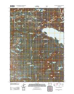
2011 Map of Willamette Pass
USGS Topo · Published 2011About this map
Willamette Pass serves as a critical high-altitude corridor for both modern recreation and transportation, anchoring this 2011 survey of the High Cascades. The Willamette Pass Ski Area and the vital railroad crossing at Cascade Summit mark the convergence of infrastructure and alpine terrain. The geography is defined by a dense network of high-elevation water bodies, including the expansive Odell Lake with its various inlets like Shelter Cove and Serenity Bay. Further west, the landscape transitions into a wilderness of smaller lakes such as Diamond View Lake, Yoran Lake, and Abernethy Lake. Interpretive details like the Waldo Lake Sno-park and Westview Shelter indicate a region heavily utilized for seasonal mountain access, while landmarks like Eagle Rock and Maiden Peak Saddle overlook the complex drainage basins of Salt Creek and Trapper Creek.
Find a feature on this map
56 named features on this map. Tap any name to fly to it.
Don’t see what you’re looking for? This feature index may not catch every label — zoom into the map to look around manually.
Map Details
Editions of this 2011 Willamette Pass Map
This is the sole edition of this map. No revisions or reprints were ever made.
Other maps of this area

1917 · Diamond Lake
USGS Topo · 1:125,000

1925 · Waldo Lake
USGS Topo · 1:125,000

1930 · Maiden Peak
USGS Topo · 1:125,000

1934 · Maiden Peak
USGS Topo · 1:125,000

1935 · Chemult
USGS Topo · 1:96,000

1941 · Chemult
USGS Topo · 1:125,000

1955 · Crescent
USGS Topo · 1:250,000

1956 · Waldo Lake
USGS Topo · 1:62,500

1956 · Summit Lake
USGS Topo · 1:62,500

1957 · Crescent
USGS Topo · 1:250,000