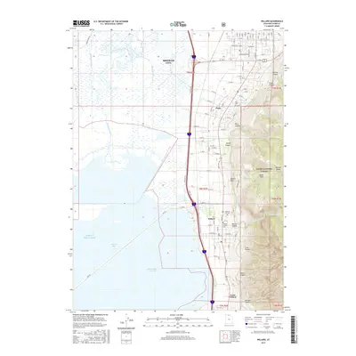
2017 Map of Willard
USGS Topo · Published 2017About this map
The dramatic transition from the high peaks of the Cache National Forest to the marshy lowlands of the Great Salt Lake defines this portion of Box Elder County. Following the base of the mountains, the communities of Perry, Willard, and South Willard are tightly clustered along the corridor between the steep canyons and the vast Willard Bay Reservoir. This settlement pattern reflects the necessity of staying near mountain runoff, such as Willard Cr and Threemile Cr, while avoiding the saline flats and sloughs further west.
Find a feature on this map
74 named features on this map. Tap any name to fly to it.
Don’t see what you’re looking for? This feature index may not catch every label — zoom into the map to look around manually.
Map Details
Editions of this 2017 Willard Map
This is the sole edition of this map. No revisions or reprints were ever made.
Other maps of this area

1914 · Logan
USGS Topo · 1:125,000

1916 · Logan
USGS Topo · 1:125,000

1954 · Whistler Canal
USGS Topo · 1:24,000

1954 · Ogden
USGS Topo · 1:250,000

1954 · Brigham City
USGS Topo · 1:250,000

1955 · Plain City
USGS Topo · 1:24,000

1955 · Mantua
USGS Topo · 1:24,000

1955 · Plain City SW
USGS Topo · 1:24,000

1955 · Bear River City
USGS Topo · 1:24,000

1955 · Willard
USGS Topo · 1:24,000