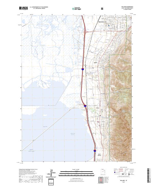
2023 Map of Willard
USGS Topo · Published 2023About this map
Willard and Brigham City anchor the eastern edge of this 2023 survey, where the steep slopes of the Wasatch Range meet the expansive wetlands of the Great Salt Lake. The landscape is defined by the contrast between the high mountain canyons like Willard Canyon and Mathias Canyon and the engineered water systems of the valley below. The Ogden-Brigham Canal and Perry Canal trace the base of the mountains, facilitating the agricultural and residential development of Perry and South Willard. To the west, the massive Willard Bay Reservoir and the Bear River Migratory Bird Refuge demonstrate the modern management of the lake's shoreline. Genealogists can identify local burials at the Willard Pioneer Cem and Willard City Cem, while the detailed street grids illustrate the contemporary growth of these Box Elder County communities.
Find a feature on this map
66 named features on this map. Tap any name to fly to it.
Don’t see what you’re looking for? This feature index may not catch every label — zoom into the map to look around manually.
Map Details
Editions of this 2023 Willard Map
This is the sole edition of this map. No revisions or reprints were ever made.
Other maps of this area

1914 · Logan
USGS Topo · 1:125,000

1916 · Logan
USGS Topo · 1:125,000

1954 · Whistler Canal
USGS Topo · 1:24,000

1954 · Ogden
USGS Topo · 1:250,000

1954 · Brigham City
USGS Topo · 1:250,000

1955 · Plain City
USGS Topo · 1:24,000

1955 · Mantua
USGS Topo · 1:24,000

1955 · Plain City SW
USGS Topo · 1:24,000

1955 · Bear River City
USGS Topo · 1:24,000

1955 · Willard
USGS Topo · 1:24,000