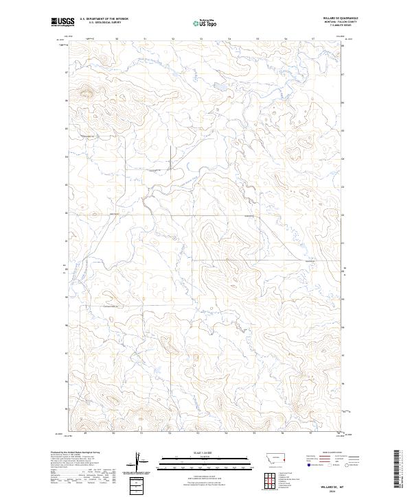
2024 Map of Willard SE
USGS Topo · Published 2024About this map
Little Beaver Creek and its many tributaries, including Hay Creek and Fletcher Creek, define this rural section of Fallon County. The landscape is characterized by a high concentration of ephemeral drainage systems like Bone Pile Creek and Dry Creek, which feed into the larger basins of the Duck Creek system. This 2024 data represents a modern look at a region where traditional land use patterns persist through limited road development. Primary access to the interior is maintained by Webster Rd and Shelterbelt Rd, while the presence of the Fletcher Creek Trl suggests a reliance on more primitive routes for navigation through the creek-bottom lands. The township boundaries of T4N R59E and T4N R60E segment this sparsely populated ranching and grazing territory.
Find a feature on this map
15 named features on this map. Tap any name to fly to it.
Don’t see what you’re looking for? This feature index may not catch every label — zoom into the map to look around manually.
Map Details
Editions of this 2024 Willard SE Map
This is the sole edition of this map. No revisions or reprints were ever made.
Other maps of this area

1953 · Miles City
USGS Topo · 1:250,000

1954 · Ekalaka
USGS Topo · 1:250,000

1956 · Ekalaka
USGS Topo · 1:250,000

1957 · Miles City
USGS Topo · 1:250,000

1958 · Miles City
USGS Topo · 1:250,000

1958 · Ekalaka
USGS Topo · 1:250,000

1965 · Ekalaka
USGS Topo · 1:250,000

1980 · Dutchmans Hill
USGS Topo · 1:24,000
1980 · Flasted Hill
USGS Topo · 1:24,000
1980 · Terrell Creek
USGS Topo · 1:24,000