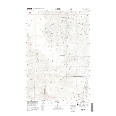
2014 Map of Willard
USGS Topo · Published 2014About this map
The Willard and Mill A communities anchor the southern portion of this landscape, situated near the Little White Salmon River and its confluence with Pine Cr. This area highlights the transition from river-bottom settlements like Mill A Flat and Mill B Flat to the high-elevation terrain of the Gifford Pinchot National Forest. A notable industrial and environmental landmark is the Willard National Fish Hatchery, positioned along the river north of the junction with Willard Rd. To the west, the Little Wind River flows through deep drainages toward Triangle Pass and the peak of Augspurger Mtn. The northern reaches are characterized by geological features such as the Big Lava Bed, while the network of forest roads, including Lost Creek Rd and Big Huckleberry Rd, provides access to interior locations like Little Wind River Camp and Goat Point.
Find a feature on this map
41 named features on this map. Tap any name to fly to it.
Don’t see what you’re looking for? This feature index may not catch every label — zoom into the map to look around manually.
Map Details
Editions of this 2014 Willard Map
This is the sole edition of this map. No revisions or reprints were ever made.
Other maps of this area

1926 · Hood River
USGS Topo · 1:125,000

1929 · Hood River
USGS Topo · 1:125,000

1953 · The Dalles
USGS Topo · 1:250,000

1956 · The Dalles
USGS Topo · 1:250,000

1957 · The Dalles
USGS Topo · 1:250,000

1957 · Bonneville Dam
USGS Topo · 1:62,500

1957 · Wind River
USGS Topo · 1:62,500

1957 · Willard
USGS Topo · 1:62,500

1957 · Hood River
USGS Topo · 1:62,500

1975 · Hood River NE
USGS Topo · 1:24,000