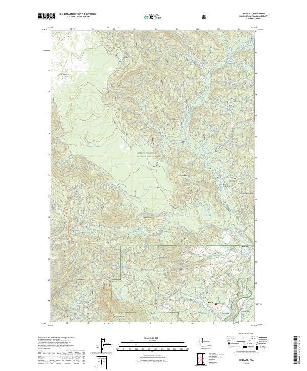
2023 Map of Willard
USGS Topo · Published 2023About this map
The Little White Salmon River and Little Wind River carve through the heavily forested landscapes of Skamania County, defining the settlement patterns found on this 2023 survey. The community of Willard is established along the eastern riverbank, while the Willard National Fish Hatchery represents a significant local landmark dedicated to the region's aquatic ecology. To the south, the clearings at Mill A and Mill A Flat indicate the area's historical reliance on timber and milling, situated near the confluence of Rock Creek.
Find a feature on this map
38 named features on this map. Tap any name to fly to it.
Don’t see what you’re looking for? This feature index may not catch every label — zoom into the map to look around manually.
Map Details
Editions of this 2023 Willard Map
This is the sole edition of this map. No revisions or reprints were ever made.
Other maps of this area

1926 · Hood River
USGS Topo · 1:125,000

1929 · Hood River
USGS Topo · 1:125,000

1953 · The Dalles
USGS Topo · 1:250,000

1956 · The Dalles
USGS Topo · 1:250,000

1957 · The Dalles
USGS Topo · 1:250,000

1957 · Bonneville Dam
USGS Topo · 1:62,500

1957 · Wind River
USGS Topo · 1:62,500

1957 · Willard
USGS Topo · 1:62,500

1957 · Hood River
USGS Topo · 1:62,500
1975 · Hood River NE
USGS Topo · 1:24,000