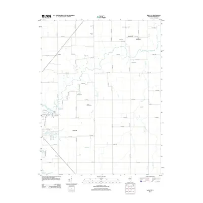
2012 Map of Willeys
USGS Topo · Published 2012About this map
Old Stonington anchors the northeastern corner of this Christian County landscape, a site of early settlement where Old Stonington Cem remains as a tangible connection to the area's pioneer history. The surrounding countryside is defined by a grid of rural roads and scattered farmsteads, including Callan Farms and Pinefront Farm. The drainage pattern is led by the winding course of Flat Br and Spring Cr, which snake through the agricultural tracts.
Find a feature on this map
49 named features on this map. Tap any name to fly to it.
Don’t see what you’re looking for? This feature index may not catch every label — zoom into the map to look around manually.
Map Details
Editions of this 2012 Willeys Map
This is the sole edition of this map. No revisions or reprints were ever made.
Other maps of this area

1923 · Taylorville
USGS Topo · 1:62,500

1925 · Taylorville
USGS Topo · 1:62,500

1946 · Nokomis
USGS Topo · 1:62,500

1947 · Pana
USGS Topo · 1:62,500

1949 · Nokomis
USGS Topo · 1:62,500

1949 · Pana
USGS Topo · 1:62,500

1952 · Assumption
USGS Topo · 1:62,500

1958 · Decatur
USGS Topo · 1:250,000

1961 · Decatur
USGS Topo · 1:250,000

1974 · Willeys
USGS Topo · 1:24,000