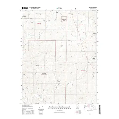
2015 Map of Willhoit
USGS Topo · Published 2015About this map
Summit City and Noble anchor the northern reaches of this Missouri landscape, which is characterized by a dense network of hollows and ridges within the Mark Twain National Forest. The map documents a predominantly rural Ozark settlement pattern, where small communities like Nottinghill and Romance are connected by a web of county roads. Genealogists will find a high concentration of burial grounds, including the Franklin Grove Cemetery, Gaulding Cemetery, and Loftis Cemetery, often situated near family-named landmarks like Della Ramsey Hollow and Bennett Hollow. The drainage system is defined by the Barren Fork and the S Fork Turkey Creek, which carve deep through the terrain toward landmarks such as Sister Knobs and Bald Jess. The presence of numerous named hollows, like Buzzard Roost Hollow and Panther Hollow, suggests a landscape deeply tied to local topographic identity and traditional land use.
Find a feature on this map
70 named features on this map. Tap any name to fly to it.
Don’t see what you’re looking for? This feature index may not catch every label — zoom into the map to look around manually.
Map Details
Editions of this 2015 Willhoit Map
This is the sole edition of this map. No revisions or reprints were ever made.
Other maps of this area

1934 · Gainesville
USGS Topo · 1:48,000

1936 · Thornfield
USGS Topo · 1:48,000

1936 · Ava
USGS Topo · 1:48,000

1937 · Buckhart
USGS Topo · 1:48,000

1940 · Gainesville
USGS Topo · 1:62,500

1942 · Ava
USGS Topo · 1:62,500

1943 · Thornfield
USGS Topo · 1:62,500

1943 · Buckhart
USGS Topo · 1:62,500

1945 · Ava
USGS Topo · 1:62,500

1945 · Harrison
USGS Topo · 1:250,000